
Corridor Implementation Plan
This study provides a roadmap for implementation, documenting several months of in-depth study. The Client Team, composed of representatives from the City of Indianapolis, Develop Indy, and the Indianapolis Airport Authority, collaborated closely with the Consultant Team to create this strategy. In addition, the team engaged with a Stakeholder Committee of political, non-profit, educational, and business leaders in the community and made several presentations to neighborhood organizations.
This study provides a roadmap for immediate-, short-term, and long-term projects and initiatives designed to advance economic development opportunities in the study area. These projects and initiatives have the power to enable transformative change and uplift the community.
Study Area
The study area includes approximately 885 acres in area (property, easements, and right-of-way) on the West Side of Indianapolis, immediately north of the Indianapolis International Airport. The Indianapolis Airport Authority (IAA) owns 105 parcels within the study area totaling around 185 acres with the remaining land consisting of 194 acres of vacant, undeveloped land and 506 acres of improved land.
The study area includes parcels fronting West Washington Street on the north and south sides, bounded by I-465 to the east and the Hendricks County line to the west. West Washington Street is the main east-west corridor bisecting the study area, paralleled to the north by West Morris Street and the south by North Perimeter Road. South High School Road, South Girls School Road, and Bridgeport Road run perpendicular to the site, providing north-south access to the West Washington Street Corridor. The West Washington Street Corridor is adjacent to I-465, providing both direct access and visibility from the interstate. South Minnesota Street and South Sigsbee Street are contained within the study area.
“Big Moves” are defined as enabling steps for development along the West Washington Street Corridor.
The West Washington Street Corridor is an auto-centric thoroughfare with harsh pedestrian conditions and a lack of accessible infrastructure. The corridor serves as a gateway to the historic Ben Davis neighborhood, westside of Indianapolis, and the Indianapolis International Airport. The airport is a major anchor to the corridor and controls a significant amount of vacant and developable land. Improving the existing conditions, activating the corridor, and strategically planning for development leverages the location of the corridor and builds the corridor into an asset for the community.
Focusing on the characteristics of the corridor and the opportunities they present will allow for the “Big Moves” to guide a development strategy and make a significant impact along the corridor.
Corridor Activation/ IAA Innovation Corridor

Strategic Development Catalytic Site Selection


14
Stakeholder Groups
30
Engagement Meetings
“Big Moves”
Creating a Gateway and Brand / “Ben Davis Station” and “Bridgeport” Anchoring the IAA Innovation Corridor
Creating a Continued Employment Infill Strategy

8
Month Long Process

Strategically Assembling Property Forming a Land Development Entity
Leveraging the Indianapolis International Airport as an Anchor

Areas of Impact
Areas of Impact include two subcategories - Primary Areas of Impact that can develop in a way that will transform this corridor and neighborhood and Secondary Areas of Impact that will support this transformation. These designations direct development activity and other targeted investments based on proximity and relationship to the corridor.
Development Strategy
Ben Davis Station

*for illustrative purposes only
Future development at Ben Davis Station focuses on attracting businesses and industries that will benefit from the adjacency to the airport, I-465, and FedEx, including advanced manufacturing, light industrial, research and development, tech uses, anchor institutions, and corporate headquarters.
This site will also serve as the gateway to the West Washington Street corridor with community amenities, mixed-use development, and a hotel. Residential development is proposed on the northern portions of the site to tie in with the existing neighborhoods.

*for illustrative purposes only
The Bridgeport Site will offer community connections and services to the surrounding area. With its location immediately south of Jameson Camp, this site has the potential to attract community-oriented uses, such as a recreation facility, sports complex, and athletic fields. A residential neighborhood is proposed on the site’s east side to create cohesion with the existing neighborhood.
*for illustrative purposes only

*for illustrative purposes only
Potential Development Phasing
Ben Davis Station Site
Phasing of the Ben Davis Station Site is envisioned to occur in three parts. Phase 1 will focus on the identified catalytic sites proposing light industrial on IAA-owned property and a community-oriented commercial and mixed-use district proposed on the sites immediately west of I-465. These sites are development-ready, and the adjacency to the airport makes them attractive for investment. Phase 1 will provide the backing for the land assemblage that needs to occur for the phase 2 development, mainly fronting West Washington Street.
Phase 2 will bring in new commercial frontage and contribute to the growth heading west along the corridor. The redesign of Minnesota Street will occur in this phase to accommodate future development and allow for better access. Depending on how development occurs, Minnesota Street may be vacated to allow for a larger developable site.
Phase 3 is a longer-term phase, looking at how potential residential development could occur north of West Washington Street. The residential development will tie in with the existing neighborhood along Sigsbee Street.

Bridgeport Site
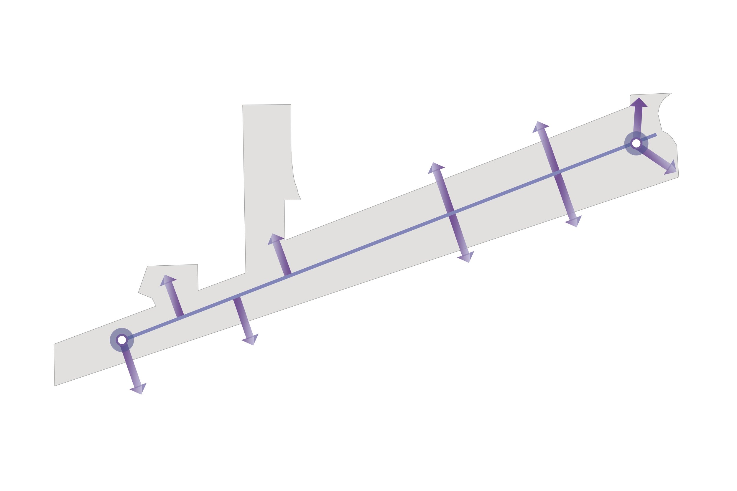
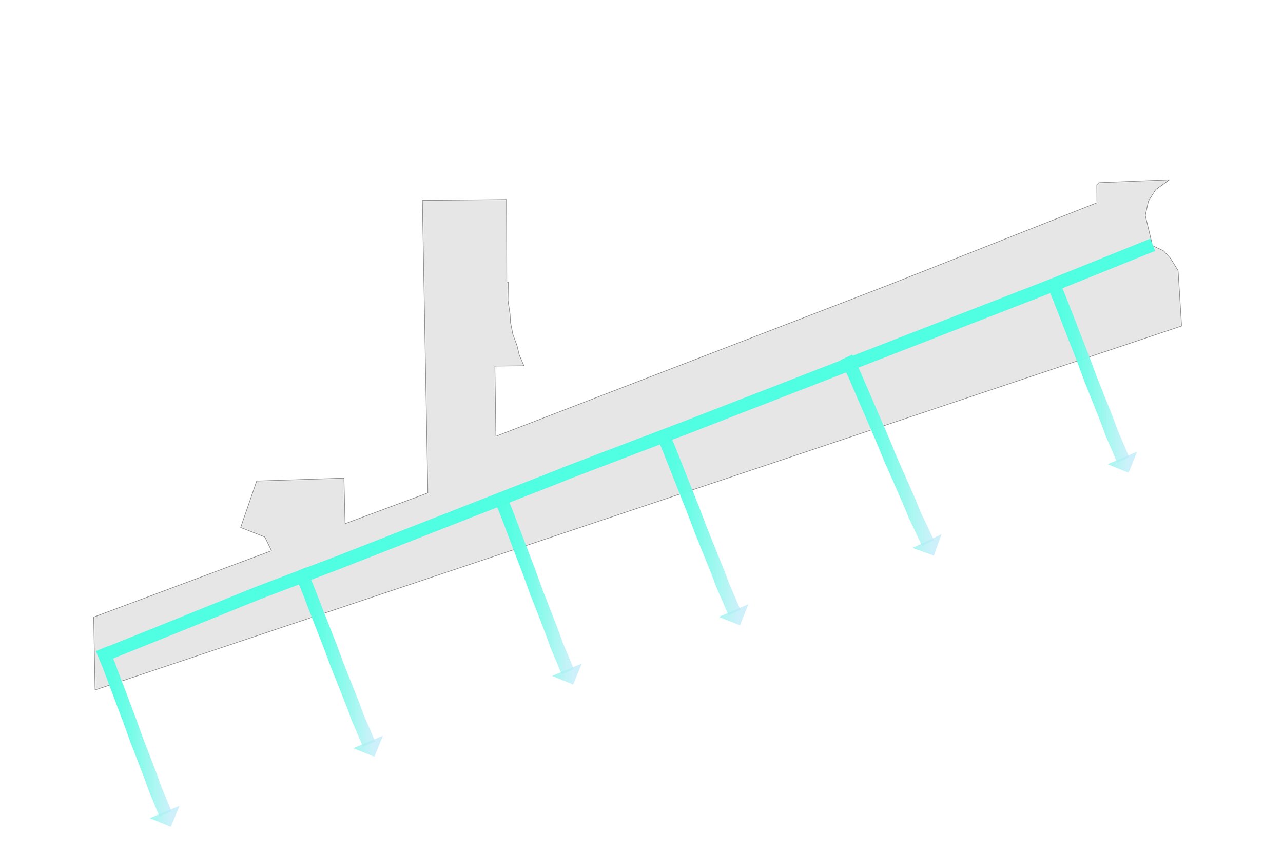
Complete Streets Strategy
Complete Streets are streets designed and operated to enable safe use and support mobility for all users. Complete Streets approaches vary based on community context. They may address a wide range of elements, such as sidewalks, bicycle lanes, bus lanes, public transportation stops, crossing opportunities, median islands, accessible pedestrian signals, curb extensions, modified vehicle travel lanes, streetscape, and landscape treatments. This study explores how Complete Street implementation can impact not only West Washington Street as a main corridor through the site, but also Minnesota Street, Sigsbee Street, High School Road, and Girls School Road.

West Washington Street serves as a main east-west thoroughfare connecting the surrounding West Side area to downtown Indianapolis.
The current conditions include two travel lanes in each direction as well as a center turning lane. Few traffic lights or traffic calming measures along the corridor causes high vehicular speeds on West Washington Street. There are minimal and inconsistent sidewalks that exist along the corridor, making it difficult and unsafe for pedestrians to navigate the corridor.
Alternative 1
The first proposed alternative design for West Washington Street recommends installing sidewalks on both sides of the road throughout the corridor. A buffer between the sidewalk and the roadway would not only separate pedestrians from vehicles, but they would present an opportunity for landscaping and street trees or other streetscape elements that would create a more comfortable and inviting experience along the corridor. In some locations, this design would require land to be returned to the right-of-way that has been encroached upon by existing businesses.
Alternative 2
The second proposed alternative plans for future increased IndyGo bus service in the study area. Designing the West Washington Street corridor to accommodate future transit amenities is important to alleviate future infrastructure costs and provide for more mobility options as they arise over time.
Implementing a bus pull-off area with a station platform and a bus lane would allow for efficient bus service of the highly-used BRT that does not hinder traffic flow on the roadway. Designing this versatility into the redesign of the corridor would make the corridor more adaptable and accommodating to future transit and development. A redesigned West Washington Street that considers future transit needs and accommodates multi-modal travel increases access for all users of the corridor.
*for illustrative purposes only

Minnesota Street
Minnesota Street bisects Site D in an east-to-west alignment which connects to West Washington Street and High School Road. Today, Minnesota Street consists of one vehicular lane in each direction without sidewalks on either side, with a main service towards vehicular traffic. The proposed alignment would add a 10-foot multi-use trail on one side, sidewalk, and landscaped lawn to buffer the sidewalk from the roadway. This design would improve access to the site and accommodate both vehicular and pedestrian traffic anticipated as a result of future proposed development. These improvements would make Minnesota Street more accessible and safe for multiple modes of transportation, especially pedestrians along Minnesota Street. Minnesota Street may be vacated as the site is developed to enable a larger site.
Sigsbee Street
Sigsbee Street runs north to south and provides access to Site C and D. Like Minnesota Street, today Sigsbee Street consists of one travel lane in each direction and no sidewalks on either side, with a main service towards vehicular traffic. The proposed alignment includes a 10-foot multi-use trail on one side, sidewalk, and landscaped lawn to buffer the sidewalk from the roadway. Consolidation of access points along West Washington Street would make Sigsbee Street a main access point and primary connection into Site D. The improvements would also provide access to the West Washington Street corridor from the existing neighborhoods and future residential development in Site C.
West Washington Street

Girls School Road
Girls School Road was recommended for Complete Streets improvements as part of the 2018 West Side Vision Plan. This corridor connects Washington Street to Rockville Road, and is in need of sidewalk and drainage improvements to accommodate pedestrians utilizing IndyGo bus and walking to work. A minimum of a five-foot sidewalk is recommended for the east side of the corridor, but if possible, the sidewalk should be upgraded to a 10-foot multi-use path. Crosswalks should be installed with a pedestrian cycle at signalized intersections along this corridor. A Rectangular Rapid Flashing Beacon (RRFB) signal and crosswalk should also be considered at the intersection of Girls School Road and McCarty Street.
High School Road
High School Road was recommended for Complete Streets improvements as part of the 2018 West Side Vision Plan. This corridor connects Washington Street to Morris Street, and is in need of pedestrian connectivity and drainage improvements to improve access in support of a mixed-use center on the east side of the street. These improvements will further connect this area to Krannert Park, create a vital pedestrian link for IndyGo bus riders and students walking from Ben Davis University, and create a walkable destination from nearby neighborhoods. A minimum of a five-foot sidewalk is recommended for the east side of the corridor, and a ten-foot multi-use path is recommended on the West Side. Crosswalks should be installed with a pedestrian cycle at signalized intersections along this corridor. A Rectangular Rapid Flashing Beacon (RRFB) signal and crosswalk should also be considered at the entrance to Krannert Park.
Trail Strategy

Vandalia Trail & White Lick Creek Greenway
Both the Vandalia Trail and White Lick Creek Greenway planning efforts have been considered in this plan. The Vandalia Trail is anticipated to run parallel to West Washington Street along Perimeter Road, and the White Lick Creek Greenway will run north following the White Lick Creek waterway.
The Vandalia Trail and White Lick Creek Greenway converge on the westernmost portion of the study area, creating an opportunity for a trailhead and/or connection point. Creating trail connections provides access to alternative transportation routes and recreational activities for residents and creates efficiencies in the trail network for visitors.
The IAA supports the Vandalia Trail extension by providing easements along Perimeter Road - this allows for a significant benefit in implementing this trail. Other Complete Streets improvements should connect to this trail infrastructure. This approach will greatly improve the ability of pedestrians to travel to this area and create amenities for future development in the surrounding area.
Aletha Dunston
Indianapolis Economic Development Director - Develop Indy
Office: 317.464.2252
Development Opportunities
adunston@indychamber.com
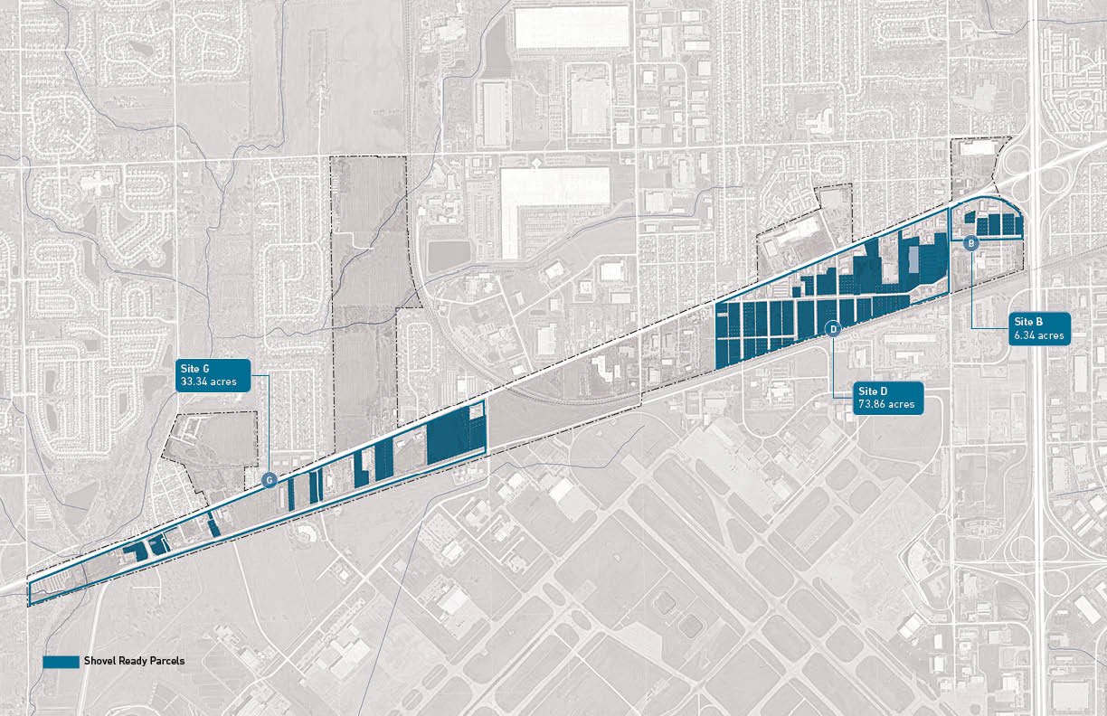
Site B - 6.34 acres
Site D - 73.86 acres
Site G - 33.34acres
The parcels identified in blue on the map are under Indianapolis Airport Authority control and are “shovel ready” for development opportunities.